

Pakistan-China collusion in Karakoram seriously threatens north Kashmir
Pravin Sawhney and Ghazala Wahab
When Chief of the Army Staff (COAS), General Deepak Kapoor told his audience during a seminar in December 2009 that the Indian Army needed to build capabilities to fight a two-front war, he was merely articulating a deep-embedded obsession within the service. With two military-held lines, in the east with China and in the west with Pakistan, and the baggage of wars and crisis with both, the Indian Army has constantly been juggling with the twin threats to nation’s territorial integrity.
General K.V. Krishna Rao was probably the first COAS in 1980 to devise a sensible roadmap to address these threats. According to him, the main threat was Pakistan, but China could not be ignored especially when the 4,056km disputed border with it was neither agreed on maps nor on the ground. His priorities, thus, were development of infrastructure with viable lines of communication along the disputed border with China over 15 years (1980 to 1995) in a step-by-step approach; and to give special attention to North Kashmir where Pakistan and China have a land link-up.
In an interaction with FORCE in 2005, he said that his military assessment was accepted by the then Prime Minister Indira Gandhi. Being an astute observer of China, who had lived through the ignominy of the 1962 war, Mrs Gandhi understood the importance of having a credible military muscle when talking with China. While giving the go-ahead to General Rao with his infrastructure development plan (Operation Falcon), the Prime Minister instructed that special attention should be given to Tawang (Arunachal Pradesh), as it should not fall in any future war with China. She also enquired if India’s action would lead to a war and use of nuclear weapons by China. Gen. Rao told her that China was unlikely to use nukes in case of a border war.
In a political goodwill decision, Prime Minister Rajiv Gandhi after his December 1988 China visit instructed that infrastructure development on the Chinese border ordered by his mother be stopped. Three reasons were responsible for this unfortunate decision. First, the 1986 Sumdorong Chu crisis with China had unnerved the Gandhi government. According to former foreign secretary Shyam Saran (Air Power journal Vol 4, Winter 2012, October-December), the then massive airlifting of troops by COAS, General K. Sundarji, ‘took the Chinese by surprise as perhaps our own leaders.’ It was said that the COAS had ordered the military build-up taking only the defence minister of state, Arun Singh into confidence; the Prime Minister, Cabinet Committee on Security and the bureaucracy in both the defence and external affairs ministries were unaware of what the Indian Army was up to. Ironically, the Chinese who did not know this were impressed by India’s swift military build-up. The Indian leadership, on the other hand, was left gasping for breath. Consequently, the military leadership was marginalised.
Second, with military leadership in the docks, the external affairs ministry prevailed on the Prime Minister’s office. They argued that infrastructure like roads and tracks should not be extensively developed near the border as the Chinese, in the event of a war, would use them to their advantage. And third, the minister of state for external affairs, Natwar Singh, who had advised and planned Prime Minister Rajiv Gandhi’s 1988 China visit, believed that it was a resounding success and so nothing should be done to displease the Chinese. This was the beginning of India’s appeasement policy towards China, which all successive prime ministers have pursued relentlessly.
Once infrastructure development was stopped, the defence planning staff in 1990-91 placed a new doctrine of one-and-half war for the approval of the chiefs of staff committee. It argued that with the military muscle dwindling, diplomacy should take on a more aggressive role in engaging China; this suited the political leadership. For the first time since 1960, the armed forces were formally seeking to be free of the nightmare of preparing for a simultaneous two-front war with Pakistan and China.
Things changed dramatically with India’s 1998 nuclear tests when India blamed China for its action; and the Kargil war the following year. While maintaining the neutrality façade, China started aggressive border patrolling to ensure that the Indian Army was unable to shift its acclimatised forces (114 brigade) from Ladakh to supplement the Kargil war with Pakistan. Interestingly, while the war was on, Pakistan COAS, General Pervez Musharraf, who started it all, was in Beijing. He was not there seeking operational wherewithal from China to fight India, something that his staff would have coordinated. He instead was in China to press its leadership to open the second front against India from the Karakoram range; essentially the unfinished agenda of 1963 boundary agreement, when Pakistan had illegally gifted 5,180 sq km of Shaksgam Valley to China hoping to link the northernmost terminal of the Line of Control (LC), map point NJ 9842 (which started the 1984 Siachen conflict) with the Karakoram pass.
This Pakistan Army’s intention was laid bare in 1989, when its COAS, General Mirza Aslam Beg, while commenting on the impact of Siachen conflict on Pakistan, had said that, “India had foiled Pakistan’s attempt to have a common border with its ally China. Pakistan had in the past ceded territory in Karakoram to China, in order to realise this objective.” Thus, one of the little understood Pakistan Army’s objectives of the Kargil war was not only to avenge its 1984 Siachen defeat by choking off Indian Army’s logistics lifeline to Leh (capital of Ladakh) and Siachen, but also to simultaneously get China to exert military pressure on Indian troops on the glacier from the Karakoram range. Beijing, however, refused to play ball, as unlike Pakistan, it did not want to bare its knuckles; the Chinese war strategy is to appear as the wronged party which is then compelled to retaliate in self-defence. In Chinese parlance, the time was not ripe.
China, thus, took two decisive steps to create conducive or ripe conditions which culminated in its successful military coercion of April-May 2013 in North Kashmir (Ladakh), when its border guards pitched tents 19km inside Indian territory in Depsang plains close to Daulat Beg Oldie (DBO) and stayed there for three weeks.
The first step by Beijing was to take advantage of the bilateral 1993 Peace and Tranquillity Agreement, which was flawed for India in two respects. It re-named the entire 4,056km disputed border as the Line of Actual Control (LAC), a term which came into being at the end of the 1962 war and meant the 320km stretch from DBO to Demchok in Ladakh (western sector) only. With this, technically speaking, the McMahon Line in the eastern sector (Arunachal Pradesh) ceased to exist. The implication on the ground was that regular, intense and unabashed intrusions by the Chinese forces started along the entire LAC.
Specific to Ladakh, the earlier mutually accepted 20km demilitarised zone on either side of the original LAC was given a go-by by China as this requirement was omitted in the 1993 agreement which had broadened the length of the LAC. This created problems in the western sector. While Indian patrols continued to restrict themselves well short of the LAC, the Chinese patrols started routinely coming up to what they considered their interpretation of the LAC. This explains why China during its temporary occupation in April-May 2013 had maintained that its forces did not transgress Indian land.
Next, on the eve of Chinese Premier Wen Jiabao’s visit to India in December 2010, Beijing announced that its disputed border with India was 2,000km and not 4,056km as believed by the Indian people. Forced to react to China’s claim by the media, the then Indian ambassador to China, S. Jaishankar said that India considered its border with China to be 3,488km. These public announcements by both sides ended possibilities of any give-and-take for a mutually acceptable border resolution, a task given to the Special Representatives of the two countries in 2003. What this implies is that a border resolution is not possible, now and into the foreseeable future. As no self-respecting nation can barter so much land for peace, India will have to continue carrying this baggage of history.
More to the point, the discrepancies stated by both nations need to be put into perspective. By slashing its border by half, China made known that it did not have a border with India in Ladakh; all that the western sector had was a LAC, which being a military line can be pushed by force by either side with gumption to do so. India, on the other hand, said that its border with China was 3,488km starting from Indira Col in Ladakh and not from the tri-junction of Afghanistan-Pakistan-Pakistan Occupied Kashmir (POK); the distance between the two points being 568km. Even as the 1994 resolution adopted by the Indian Parliament spoke of the entire POK being an integral part of India, the Indian government makes a distinction between its disputed borders with Pakistan and with China. This has been done to ensure that border resolution with Pakistan remains a bilateral issue and the two border disputes do not get intertwined.
China probably has a water-tight legal case in declaring that its border with India in Ladakh (western sector) has always been undefined. What it had was a frontier with British India, which denotes the limits of a nation’s political and military influence which fluctuated between the Kuenlun and Karakoram ranges. According to A.G. Noorani who has done extraordinary research in his book titled, India-China Boundary Problem 1846-1947: ‘On 24 March 1953, a decision was taken to formulate a new line (unilaterally) for the boundary (in the western sector). Prime Minister Jawaharlal Nehru’s directive of 1 July 1954 was apparently in pursuance of that decision. It was a fateful decision. Old maps (of 1949 depicted pre-partition India which were also annexures of Mountbatten’s elaborate report on his Viceroyalty) were burnt.’ Once the new maps were printed, Nehru in his reply of 22 March 1959 to Chinese Premier Zhou En-lai asserted that, “A treaty of 1842 between Kashmir on the one hand and the Emperor of China and the Lama Guru of Lhasa on the other, mentions the India-China boundary in the Ladakh region. In 1847, the Chinese government admitted that this boundary was sufficiently and distinctly fixed.” Noorani goes on to prove on the basis of archival documents that Nehru’s assertion was historically untrue. ‘As late as 1950, to go no further, Indian maps showed the boundary as undefined.’
It is another matter that Zhou during his April 1960 visit to Delhi said at the press conference that China ‘was willing to define the boundary in the west as the line which runs from the Karakoram pass south eastwards roughly along the watershed of the Karakoram mountains to the Kongka pass,’ a position which was unacceptable to Nehru. Noorani sums up by writing that: ‘A century-old boundary problem was neglected, by a conscious decision in 1954 (to burn old maps). It acquired the dimensions of a boundary dispute in 1959. Unresolved in 1960 when the prospects of a fair settlement were bright, the dispute was sought to be resolved by a confrontation. India’s attempt to revise the status quo in 1961 by the Forward Policy in the west came to grief. China decided to settle the matter by recourse to war in 1962.’
Twice in April 1960 and June 1980 (by Deng Xiaoping), China had sought to settle the western frontier with the boundary line along the Karakoram range with the Karakoram pass remaining common to both nations. Today, this option is not available to India. For instance, during all border talks with India, China had behind closed doors told Indian interlocutors that it would not discuss the area west of the Karakoram pass, without giving the reason that it would hurt Pakistani sensitivity. This was consistent with China’s public position that Kashmir was a bilateral dispute between India and Pakistan. This stance changed after December 2010, when Beijing declared that it had no border with India. By implication, this meant that the LAC in Ladakh between India and China is on Pakistani land; India and not Pakistan is the occupation country. In short, the India-Pakistan dispute over Kashmir which was interwoven with India-China dispute for the western sector are no longer separate as India had desired all along.

Given these geo-political realities, the military dynamics in the western sector between India on the one side and China and Pakistan on the other will also get intertwined, implying a more overt rather than covert support between the two. Three news reports ought to be mentioned in this context. The Indian COAS, General V.K. Singh in October 2011 mentioned the presence of a Chinese People’s Liberation Army’s brigade worth (about 4,000) of troops in POK. This was promptly denied by China; it was instead suggested that the forces were civilian engineers working on the Karakoram Highway which was initially constructed in 1978. Next, a memorandum was signed between Chinese Premier Li Keqiang and Pakistani Premier Nawaz Sharif in July 2013 to upgrade the treacherous Karakoram Highway which runs from China’s Kashgar to Pakistan’s Gwadar deep-sea port into an all-weather four-lane land corridor. The Chinese had earlier taken over the management of the Gwadar port from Singapore in February 2013. And importantly, the two allies signed an agreement under which China would lay down fibre-optic cables from Xinjiang province to Islamabad and Rawalpindi for secure and all-weather communications.
What do the changed geo-political and military realities mean for India in North Kashmir?
Military Threat
Before we discuss North Kashmir, the larger issue made by General Deepak Kapoor about a two-front war, needs to be examined. In 2004, when FORCE team had visited 33 corps headquarters in Sukhna responsible for the defence of Sikkim, it was told that military threats from China on the entire Tibetan Autonomous Region (TAR) were of three levels: low, medium and high. The categorisation of threats was based upon Chinese capability to bring troops to TAR. This was the situation in 2009 as well, which General Kapoor, after retirement in March 2012 confirmed to FORCE. In the low level, China is expected to bring five to six divisions to war; in the middle level, they will have capability to bring eight to 12 divisions to fight a short, intense war; and in the high level threat, they could muster between 18 to 20 divisions on the border with India.
Thus, the army’s accretion plan which was initiated by General Kapoor and included two divisions to be raised by March 2012, followed by a mountain strike corps, which commenced raisings on 1 January 2014, was based on the above assessment of Chinese threats. This situation has altered, with the army’s perspective planning directorate now suggesting that given the increased Chinese capability and capacity due to rail links to TAR, it could, in case of a border war, come with maximum punch against India. Thus, the army will need to prepare for the high level threat at the onset of the war. Moreover, it has been assessed that China will restrain Pakistan to not open a second front against India in the event of a border war, as India will be viewed as the underdog by the international community. The reverse may also be true. In case of a war between Pakistan and India, China would hesitate to open the second front, and would assist Pakistan only with operational logistics as it has been doing in the past. If the army’s present assessment holds good, then the call by General Kapoor to prepare for a two-front war should stand superseded. Even the army’s argument that it needs the new mountain strike corps to shift its doctrine to ‘deterrence’ from ‘dissuasion’ ought to be restrained. While not deterring China, it could lead Pakistan to pursue an arms race.
Interestingly, the above military assessment does not apply to Jammu and Kashmir, where there are three military lines with distinctive features. The LAC with China is not accepted by either side; the LC with Pakistan ends at northernmost map point NJ 9842; and the so-called Actual Ground Position Line by India on the Siachen glacier (Ladakh) is actually on no-man’s land.
This should lead to the inevitable military conclusion that a Chinese-Pakistani military pincer in Ladakh is a plausible threat. For the first time, the possibility of the Siachen glacier held by Indian troops in no-man’s land is threatened both from the west and east. The irony around the Siachen glacier conflict is unmistakable. When Indian troops rushed before Pakistani troops and occupied the glacier in 1984, they did so much like the Sixties’ forward policy, when posts were occupied against China in NEFA (now Arunachal Pradesh), without regard to their operational logistics. The then northern army commander, Lt Gen. M.L. Chibber later confirmed to FORCE (December 2004 issue) that, ‘Siachen does not have any strategic significance.’ It seems the military leadership at that time was oblivious of the geo-political importance of the region.
Years later, around 2002, India’s 102 infantry brigade, responsible for the Siachen conflict, gave out an unclassified briefing listing why an occupation of Siachen by India was critical. The reasons give were:
• The Siachen region acts as a wedge between the Shaksgam valley and Pakistan occupied Baltistan. If controlled by Pakistan, it would give legality to ceding of Shaksgam valley as per the Sino-Pak agreement of 1963.
• The power that control the Siachen region would have a military advantage over Shyok and Nubra valleys and would become the dominant power in the region.
• Its control by Pakistan would also provide depth to the Karakoram Highway.
• Occupation of Siachen by our adversary would also threaten Sub Sector North (the eastern side of the glacier in Ladakh facing China) and would facilitate outflanking of our defences, and
• This area would provide an opportunity to Pakistan and China to operate in collusion and threaten northern Ladakh. This would compel us to recoil our defences on Ladakh range.
Once this new two-front military threat is grasped, it should be clear that this threat ought to be contained within the J&K theatre as broadening it outside the LC to the international border will bring nuclear weapons with Pakistan into war-planning. The better way to do this is not by continuing with the existing defensive and anti-infiltration stance adopted by the Indian Army but by re-orienting troops to an offensive posture in order to keep the Pakistan Army under pressure. The objective is not to start a war with Pakistan, but to give Rawalpindi only two options: to either divide its attention between two hot-fronts, or to concentrate on its western front in Afghanistan by supporting the Nawaz Sharif government in finding the Kashmir resolution with the next government in India. Translated in military terms, the Pakistan Army will find it necessary to check infiltrations across the LC as these would hamper the bilateral peace. Thus, for Indian security forces, the status quo is the self-defeating option, especially when a window of at least three to five years is available before stability comes to Afghanistan after which the snowballing threat to Ladakh would become imminent.
The Way Forward
Here are 12 suggested actions that the political leadership should consider in pursuance of the above mentioned objective.
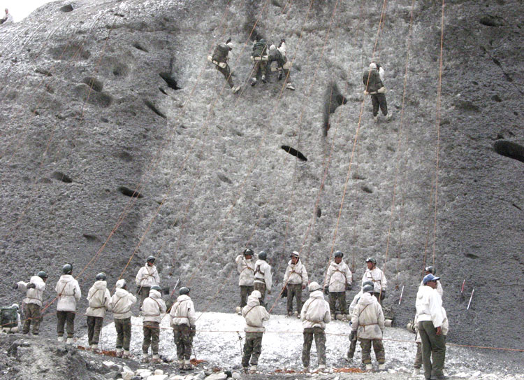
• One, strategic road and air connectivity to Ladakh should be improved on a war-footing. Of the two roads that connect Ladakh with mainland India, the road through Himachal Pradesh (Manali-Leh) is shorter but more treacherous, and prone to landslides, reaching altitudes as high as 17,400feet (Tanglang la), and is closed for the good part of the year. The other Srinagar-Leh road is longer, less difficult, and should be available round the year if the two-tunnels on it are constructed. Work on the ‘Z mod’ tunnel before Sonamarg should be hastened and the Zoji la tunnel should get sanctioned soon. Regarding operational roads, there are two class-9 roads which facilitate forwards troops in eastern Ladakh and need to be constructed without further delay. These roads were sanctioned by the Vajpayee government in 2002, but unfortunately, work on them is still not complete. The situation has become more difficult with the accretion of Indo-Tibetan Border Police (ITBP) battalions which provide the first line of defence against China and are depended on the army behind them for operational logistics and administration. From the earlier one battalion each at DBO, Demchok and Chushul, the ITBP has nearly nine battalions spread across the SSN, Sub Sector Central, and Sub Sector South which comprises eastern Ladakh.
• Two, the Nyoma Advanced Landing Ground which is 102km from the LAC should be developed into a full-fledged runway with airport. More civil flight instead of the present four in a day should be operated. Delhi should know that welfare and integration of local population adds to border security. • Three, Leh and Thoise air stations across the Khardung la should be developed with Su-30MKI aircraft stationed in both. This will provide operational flexibility to the air force in case of a crisis with China.
• Four, 14 corps in Ladakh should operate at the operational level of war where the corps commander does not report to the northern army commander but directly to the COAS. This, given peculiarities of this formation, is necessary. The entire 14 corps is in high altitude area between heights of 10,000 feet and 21,000 feet. With snow blocking the Srinagar-Leh road which passes through the awesome Zoji la pass, the corps zone remains cut-off from the rest of Jammu and Kashmir for six to seven months in a year. And, with the frontage of 1,162km, the corps zone has a 238km LC and a 110km Actual Ground Position Line (along the Siachen glacier) with Pakistan, and 814km LAC with China.
• Five, the single military satellite, called the Technical Experimentation Satellite (TES) in the low earth orbit about 450km from the earth launched in 2002 is not enough. Given Chinese anti-satellite (ASAT) capabilities demonstrated in 2007 and 2009, more TES are required on priority basis. The TES is suited for general identification of Pakistani gun areas, helipads, logistics areas, upgradation of roads and tracks, large convoys, and even ballistic missile sites.
• Six, the army should move up to 70 per cent of its 80,000 Rashtriya Rifles (RR) forces on counter-insurgency (CI) operations to forward zones close to the LC. The task of internal stability should be handed over progressively to the paramilitary and state police with the army helping them with training their Quick Reaction Teams in its two corps battle schools in the theatre.
• Seven, the fence (called Anti-Infiltration Obstacle System) along the LC should be dismantled as it instils a defensive mindset in troops.
• Eight, the RR and troops in the forward zone should undertake conventional training and move away from the anti-infiltration posture. To enhance the night fighting capability of infantry, troops were provided with imported Hand Held Thermal Imagers (HHTI), night vision goggles and binoculars, and holographic aiming sights for rifle and carbine after the 1999 Kargil war. Unfortunately, these are old now and need replacement.
• Nine, Special Forces available with the northern command should be moved closed to the LC, and Ghatak (commando) platoons with LC battalions should identity and train on targets across the LC.
• Ten, war wastage reserves for ammunition, missiles and specialised and precision ammunition should be made up, and operational logistics tunnel should be constructed earliest.
• Eleven, an armour brigade each for Ladakh and the Akhnoor brigade should be made available soon.
• And twelve, generals with vast experience in CI ops should be posted out of the theatre.