

Overstretched Assam Rifles, Myanmar coup combine to disturb Northeast’s security & social balance
Mohammad Asif Khan
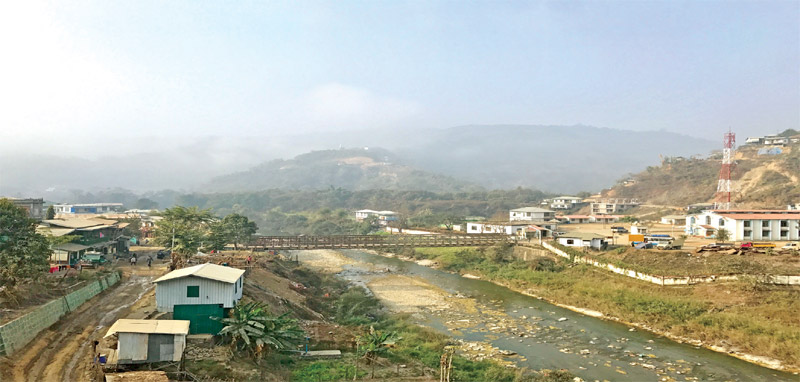
Navigating the intricacies of the India-Myanmar border has always been complex and challenging. But after the 2021 military coup in Myanmar, this border has become fraught with tension with the growing influx of refugees, narcotics and arms through the porous border. The complexity is further aggravated by the terrain and the topography of the area.
“Guarding the Indo-Myanmar Border (IMB) demands utmost perseverance,” says former Assam Rifles (AR) director general Lt Gen. H J S Sachdev (retd). “The border traverses unforgiving high mountains, dense jungles and intricate river networks. Navigating through such terrain under the humid climatic conditions requires unparalleled physical endurance.”
One of the major challenges, Lt Gen. Sachdev points out, is the border’s porosity compounded by the Free Movement Regime (FMR) agreed between India and Myanmar in 2018. The FMR permits people residing along the India-Myanmar border to travel up to 16 kilometres across the boundary without visas. Designed to facilitate historical nomadic movement and maintain socio-cultural ties, the FMR aims to address the unique circumstances in the region’s border populations in which families found themselves divided by a hard border.
“The absence of a fence, coupled with the FMR, means that crossings are not limited to official checkpoints. This opens the door to illegal migration and smuggling,” he emphasises. The border’s permeable nature poses a constant test to maintaining adequate security measures.
The lack of infrastructure, particularly roads and tracks leading to the border, emerges as another complicating factor. “Permanent posts close to the border are hindered by logistical constraints, impeding swift response and deployment,” Lt Gen. Sachdev says. The daunting journey from the hinterland to the border exposes security forces to risks and strains, further underscoring the operational difficulties.
An environment marked by hostility and unfriendly neighbours exacerbates the challenge of effective border management. “Militant groups hostile to India have found sanctuary across the border, fostering links with narcotics smuggling,” notes Lt Gen. Sachdev. The emergence of narco-terrorism as a significant concern along the border adds layers of complexity to an already intricate situation.
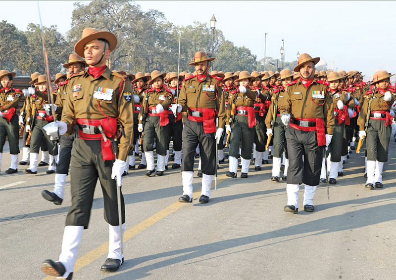
In 2010, the ministry of home affairs (MHA) suggested AR’s replacement by the Border Security Force (BSF). The ministry argued that the open border needed permanent vigil, which the BSF’s Border Out Post (BOP) style of deployment would ensure. The proposal also envisaged AR’s disbandment by merging its troops with the ITBP and the army. Since the AR is officered by the army and the army faces a shortage of officers, postings with AR would affect army operations. The AR’s suggestion of raising its own officer cadre was not considered.
But the proposal was met with resistance from the ministry of defence (MoD). It argued that the AR had a historic dual role of internal security and border guarding, making it uniquely equipped to handle complex challenges along the India-Myanmar border. Moreover, given the lay of the land and the historicity of India-Myanmar relations, AR’s Company Operating Post (CoP) method was more suitable.
Even though the proposal didn’t take off, former additional director general of the BSF, S K Sood believes it would have been a sensible move. He says “the BSF is better suited to guard the Indo-Myanmar border. It has over 57 years of experience... maintaining 24x7 presence on the borders by establishing BOPs close to the border.”
According to him, the dual role of internal security and border guarding leaves the AR with inadequate troops for effective border management. “Borders are not continuously manned to intercept illegal infiltration and prevent border crimes,” he adds, which leaves gaps in the AR’s effectiveness.
“Effectiveness hinges on maintaining lines of communication in such a demanding environment,” says Lt Gen. Sachdev, adding that a crucial aspect is the paucity of troops dedicated to guarding the IMB. “The Assam Rifles, the primary force for this role, faces the challenge of balancing border security with managing the hinterland,” he points out. The current deployment of 15 battalions is vastly inadequate, requiring three times the present strength to effectively seal the border.
Baggage of History
Stretching across 1,643 km, the IMB traverses several northeastern states, including Mizoram, Manipur, Nagaland and Arunachal Pradesh. The border delineation was carried out by the British in 1826 without considering the input of the local populace.
The McMahon Line, defined during the Simla Conference of 1913-1914, played a pivotal role in shaping India's northeastern boundary and its relationship with Myanmar. Following Burma's separation from British India in 1937, negotiations and agreements were established to demarcate the border after Burma’s independence in 1948. This process involved historical records, geographical surveys and diplomatic discussions.
Over the years, minor adjustments to the border may have been carried out because of geographical changes or to address specific concerns of border populations. The region’s historical nomadic tribes and their fluid movement across international boundaries complicated the delineation process. To accommodate these unique circumstances, the FMR was established, allowing people residing along the border to move up to 16 kilometres across the boundary without visas, maintaining historical ties.
You must be logged in to view this content.