

TAR is a model of growth and development while Ladakh and Uttarakhand seriously lag behind
Prasun K. Sengupta
While areas all along the Line of Actual Control (LAC) within TAR (Tibetan Autonomous Region) have excellent all-weather connectivity and habitability, the exact opposite holds true in eastern Ladakh, Uttarakhand, Sikkim and Arunachal Pradesh, where vast areas astride the LAC remain remote, utterly backward, and are being abandoned by its own residents because of lack of facilities and connectivity.
The foundational framework for improving transportation and habitability infrastructure is ‘civil-military integration’, which mandates that all existing and planned infrastructure of any type must be of the dual-use-type. For instance, in 2015, a joint statement from the People’s Liberation Army Air Force (PLAAF) and the Civil Aviation Administration of China (CAAC) mandated that civil-military integration would include joint maintenance of airport support facilities, joint flight safety support and joint airport management.
Notably, the Lhasa Gonggar Airport in Tibet and Sunan Shuofang International Airport in Wuxi in Jiangsu province were the first two pilot airports to implement such integration concepts in the second half of 2015. The ‘civil-military integration’ concept follows from the edict issued by China’s President Xi Jinping, who has declared: “Govern the nation by governing the borders; govern the borders by first stabilising Tibet; ensure social harmony and stability in Tibet and strengthen the development of border regions.”
Airport Infrastructure
Last year, Lhasa received a record four million passengers according to the CAAC. The passenger volume at Gonggar Airport, the largest airport in the TAR, exceeded two million in 2013, and three million in 2016. TAR presently has 10 airlines operating a total of 81 routes. It was estimated that the airport saw the arrival of 4.3 million passengers by the end of 2018.
In March 2017, the second-largest airport terminal in TAR commenced operations in Nyingchi. This terminal, the sixth to open in TAR, is located at Nyingchi Mainling Airport at an elevation of 2,950 metres above sea-level. It covers an area of 10,300 square metres and will be able to handle 750,000 passengers and 3,000 tonnes of cargo annually by 2020. Incidentally, the Bayi Township, owned by the PLA and located nearby, is served by the same airport.
On 9 June 2018, the CAAC and the TAR government announced that Tibet would soon have three new airports. Construction of the three airports, all above the altitude of 3,900 metres, should begin in 2019. One will be located in Lhuntse in Lhoka (called Shannan by Beijing) area, north of the Upper Subansiri and Tawang districts of Arunachal Pradesh; the second will be between Tingri and Lhatse counties of Shigatse City, north of Zangmu, the border post with Nepal; and the last in Purang, near the Nepal-TAR-India tri-junction, north of Pitthoragarh district of Uttarakhand. While Tingri Airport is near the Nepali border, the two others (Lhuntse and Purang) are at a short distance from the LAC. All three airports will become operational in 2021 — by then, there will be eight airports in TAR (plus three in Xinjiang, i.e. Kashgar, Hotan and Yarkand).
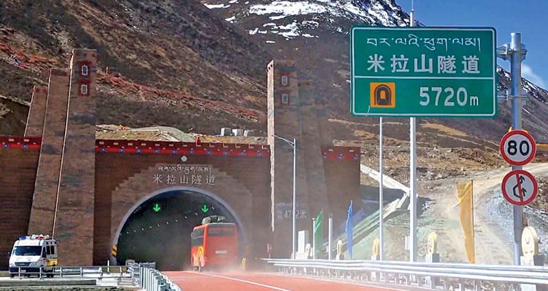
Rail Connectivity
In September 2018, China Railway’s 11th Bureau successfully laid the first group of ballasts for the Gonggao station, a new station in the single-track ‘Lalin’ railway line, Sichuan-Tibet railway — a key project of the National 13th Five-Year Plan. Upon completion, it will become another railway artery connecting TAR with the mainland. The ‘Lalin’ section is relatively easier to build than the eastern part (Nyingchi-Chengdu). It will have a total length of 435km with 34 new stations, out of which 17 already exist. It will start in Lhasa and the terminus will be at Nyingchi City and follow the course of the Yarlung Tsangpo (Brahmaputra) River. Construction of this section began in late 2014, with completion due in 2021. Speed of the train will be 160kph, and it will also be the first electrified railway in TAR. The line will cross the Yarlung Tsangpo 16 times, with the bridges using large-span bridge structures. Since the mountains are high in water depth and the rivers are rushing, the technology is special, and the construction is extremely difficult. There are 14 high-risk tunnels out of 47 tunnels, of which seven are extremely high-risk tunnels. The total length of bridges and tunnels on the Lhasa-Nyingchi Railway is 331km, 75 per cent of the total distance of the line. Of these, there are 120 bridges totalling 84km, which account for 21 per cent of the length of the line.
In addition, there are several new railway lines planned for laying within TAR, such as:
- The Lhasa-Shigatse-Kyirong section, which should be completed in the first half of the next decade (it was delayed due to the 2015 Nepal earthquake).
- The Lhasa-Yatung section reaching the Chumbi Valley and the Sino-Indian border in Sikkim.
- The projected Yunnan-TAR railway line, which will join the Sichuan-Nyingchi line somewhere near Chamdo.
- The Korla-Golmud line is already under construction. It will be the second major railway line linking Qinghai province to Western Xinjiang.
- The Shigatse-Rutok-Kashgar line, which is likely to follow the G-219 Highway (known as the Aksai Chin road).
- A new Qiemo-Korla line across the Taklamakan Desert, following the course of the G-216 Highway.
- The Hotan-Quiemo line in Xinjiang that will link up with the Khotan-Kashar line.
- The Hotan-Tashkurgan line, leading to the border with Afghanistan in the Wakhan Corridor. Tashkurgan has historically been part of the Silk Road. Major caravan routes in ancient times had converged leading to Kashgar in the north, Yecheng to the east, Badakhshan and Wakhan to the west, and Chitral and Hunza to the southwest.
- A project to link Chengdu in Sichuan to Golmud in Qinghai. It will close the loop linking the two provinces on the West and North of TAR and link up Xinjiang through the Golmud-Korla line.
You must be logged in to view this content.